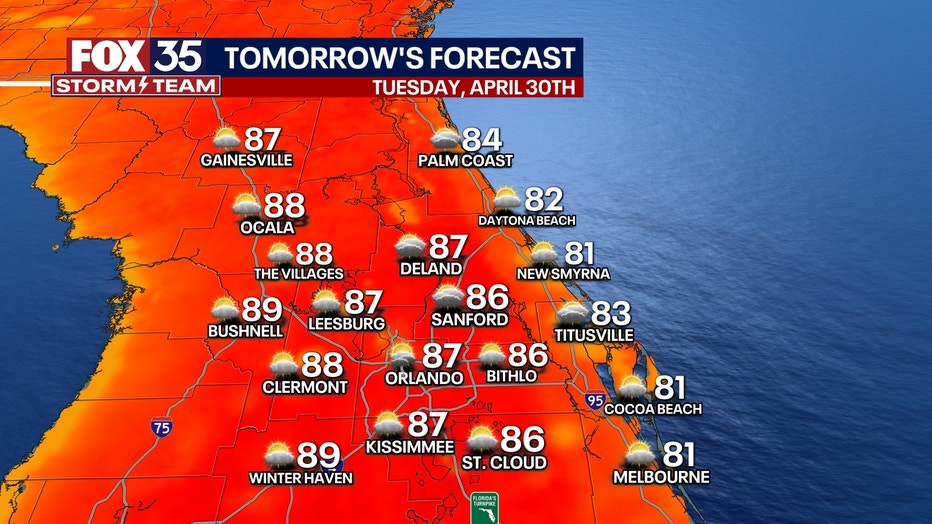
Orlando weather: Temps to reach the 90s this week in Central Florida; rain possible
Orlando Weather Forecast: April 29, 2024
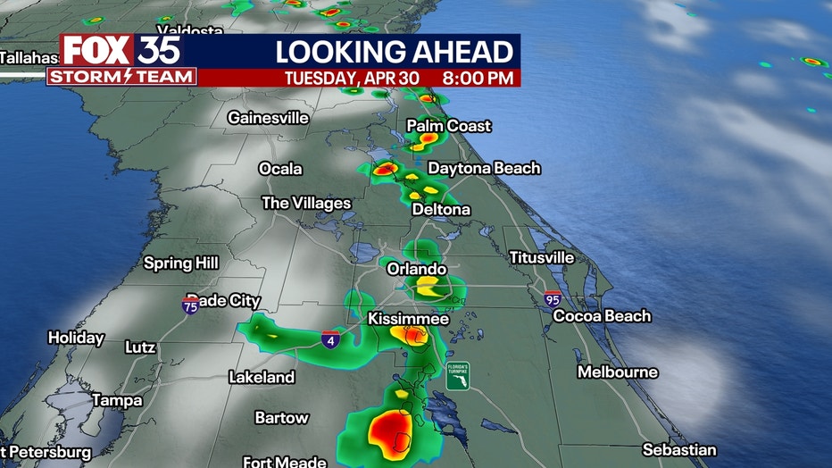
There is a slight chance for rain on Tuesday afternoon and early evening across portions of Central Florida.
ORLANDO, Fla. - Central Florida is set to experience a unique weather phenomenon this week that is familiar to many natives and longtime residents: the East Coast and West Coast sea breezes will converge on Tuesday and Wednesday afternoons and evenings.
This convergence may result in a few isolated showers and thunderstorms developing from mid-afternoon into the mid-evening hours, gradually moving eastward during this period. However, forecasters do not anticipate severe weather conditions, with only typical showers and garden-variety thunderstorms expected.


Looking ahead, Thursday through the weekend is forecast to be mostly sunny in Central Florida, with temperatures reaching the high 80s to near 90 degrees Fahrenheit. While there is a slight chance of isolated afternoon thunderstorms over the weekend, forecasters do not anticipate any significant disruptions.
Overall, major rain or significant weather systems are forecast to remain absent from Florida's weather pattern for the foreseeable future.
Is this early in the season for sea breeze storms?
The convergence of sea breezes is the same pattern that defines the rainy season, but one we usually don't see regularly until late May to early June. It usually holds off until then because the atmosphere has to contain a certain amount of humidity, mainly controlled by the ocean water temperature. The warmer the water, the more moisture becomes evaporated into our air and the higher the chance that colliding sea breezes can produce convective clouds.
Warm ocean temperatures are why summer here feels humid compared to the drier winter and spring months.
This week, our air will be transported in from the warmer Caribbean, producing clouds and rain when the sea breezes collide — just like in summer. However, unlike summer, atmospheric moisture will not be quite as high, so we're likely to see only a 30% chance instead of the rainy season's 60%+ daily afternoon chances.
The overall pattern also suggests that even warmer weather will develop next week, sending temperatures 7-11° warmer than normal, which translates into the mid-and upper 90s by next weekend (May 11-12).
It's no secret that water temperatures are unusually warm in the main development region of the Atlantic— the central and eastern part of the ocean, where most hurricanes form.
Orlando Hour-by-Hour Forecast

Meanwhile, in our local waters, temps are slightly below normal. Even with our slightly below-normal temps, it won't take much to send us beyond the threshold needed to kick off the rainy season and once it gets going, there's no shortage of warm water.
We're also still expecting a very busy hurricanes season, so while we enjoy this quiet time, start thinking about your preps and watch for upcoming tax-free weekends to purchase hurricane supplies.
Orlando 7-Day Forecast


