

Orlando weather: Cool evening ahead of weekend with highs into mid-90s, limited rain chances
ORLANDO, Fla. - Passing clouds will stick around for the rest of the evening with mostly clear skies overnight across Central Florida.
What will the weather look like tonight?
What To Expect:
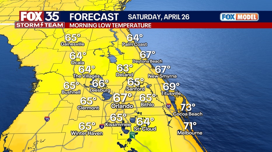
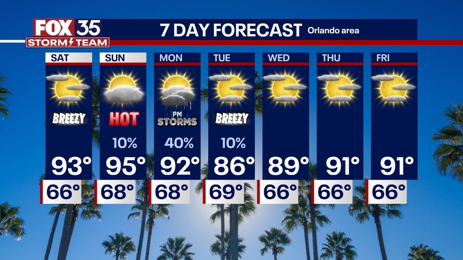
Temperatures will be mild and conditions will be humid tonight. Lows will fall into the middle to upper 60s early Saturday morning.
What will the weather look like this weekend?
What's next:
The weekend is going to get HOT, HOT, HOT!
Overall, the weekend will be sunny, hot and humid with low chances of rain. Make sure you stay hydrated and wear plenty of sunscreen. The UV index will be between 7 and 9.
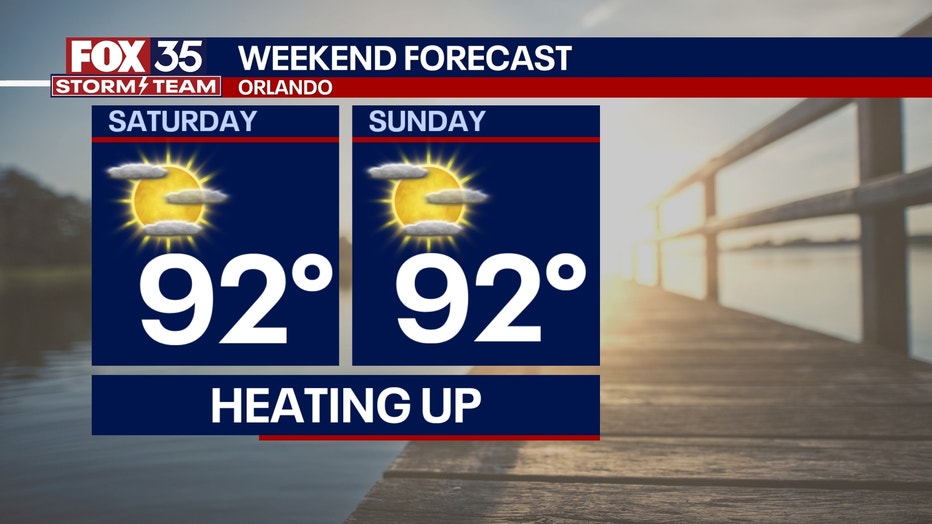
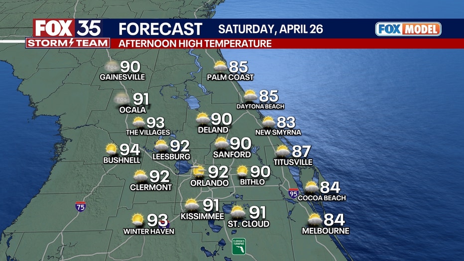
The heat on Saturday will make for a great beach day. Just make sure you are careful in the water or swim close to a lifeguard; rip currents will be moderate to high all weekend long. Highs will be in the low 90s.
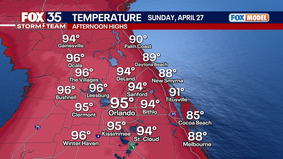
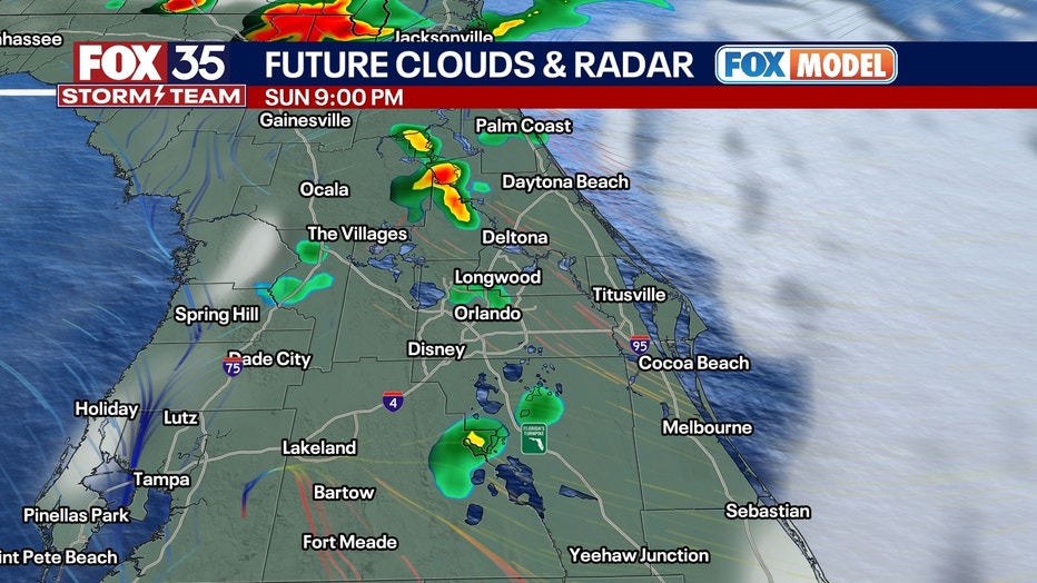
Sunday will be even hotter, but there is a slight chance of rain finally back in our future. Highs will push into the mid-90s.
On Sunday night, a cold front starts to dip down into the Florida Peninsula, but it will only have just a little moisture to work with. That and the seabreeze coming off the coast could spark up a few showers or a stray thunderstorm along the I-75 corridor.
Central Florida drought continues
Dig deeper:
The drought stretching across Central Florida is continuing.
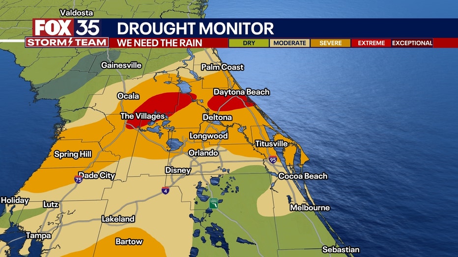
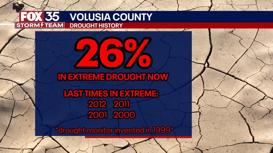
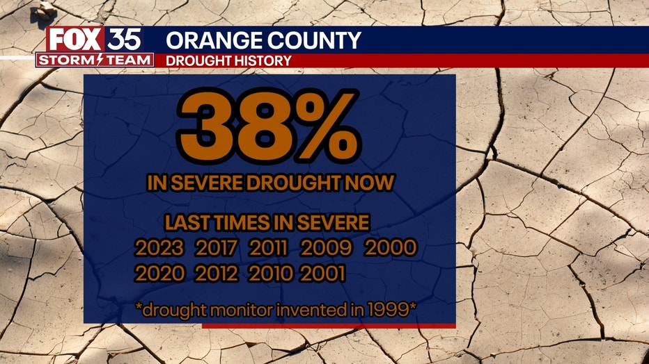
On Thursday, the U.S. Drought Monitor's once-weekly update elevated parts of Central Florida to an "Extreme Drought" reading, as well as expanded the "Severe Drought" reading across other areas.
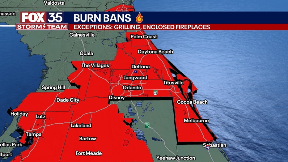
LOOKING AHEAD: More scattered storms pop up on Monday afternoon with a 30% chance of showers and thunderstorms. These downpours will be isolated and will also pop up along and near the I-75 corridor. We desperately need rain, so as this rain is very much needed, just this one day of showers will not fix the current extreme drought conditions in the region. Burn bans are in place for most of Central Florida.
By the middle of next week, we will see more of a pattern change. This means much higher chances of beneficial rain will be on the way, with multiple rounds possible.
FOX 35 Storm Tracker Radar and Live Weather Cameras
Track live when storms move across your area using the FOX 35 Storm Tracker Radar below. You can also watch as heavy rain moves across Central Florida on our Live Weather Cameras' page here.

More radar maps from FOX 35 Storm Tracker Radar
- Brevard County
- Flagler County
- Lake County
- Marion County
- Osceola County
- Orange County
- Polk County
- Seminole County
- Sumter County
- Volusia County
- U.S./National Radar
STAY CONNECTED WITH FOX 35 ORLANDO:
- Download the FOX 35 News app for breaking news alerts, the latest news headlines
- Download the FOX 35 Storm Team Weather app for weather alerts & radar
- Sign up for FOX 35's daily newsletter for the latest morning headlines
- FOX Local: Stream FOX 35 newscasts, FOX 35 News+, Central Florida Eats on your smart TV
The Source: This story was written based on information shared by the FOX 35 Storm Team on April 25, 2025.