Orlando weather forecast: Will storms stick around for the weekend?
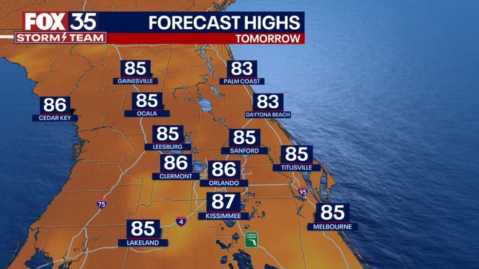
ORLANDO, Fla. - Today's high: 90 degrees
Tonight' low: 74 degrees
Rain: 70% chance PM Storms
Main weather concerns:
Another hot and humid day across the Florida peninsula. Highs will reach the upper-80s to around 90 across the interior with feels-like temperatures in the triple digits. Showers and storms return-mainly after 2 p.m. for most locations. Rain chances peak at 70% over the inland counties and along the east coast beaches.
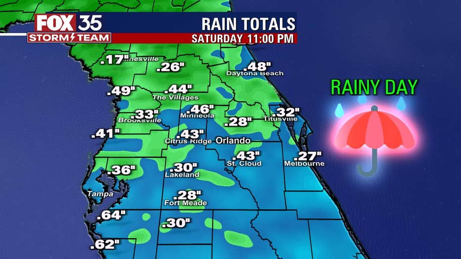
The main storm threats include heavy rain, gusty winds and plenty of lightning strikes. Stay weather aware and download the FOX 35 Storm Team weather app.
BEACHES:
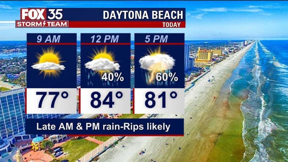
It will be a dry and muggy start to the day at the beaches. Stay weather aware this afternoon/ evening for AM + PM storms containing lightning. Rain chances peak around 60%. There is a high rip current risk at all east coast beaches through at least this evening. Surf is in the 1-2' in a Northeast swell.
THEME PARKS:
It will be another hot and humid day with feels like temperatures in the triple digits. Stay hydrated and take breaks inside the a/c. Best chance for rain between 3pm-8pm. Heavy rain and lightning will be likely.
EXTENDED OUTLOOK:
Daily storm chances are on the rise for the rest of the week. A front sinking south into Florida will keep tropical moisture elevated across the Florida peninsula. Keep you umbrella handy this week. Late weekend brings lower rain chances with that trend continuing through next week.
TROPICS:
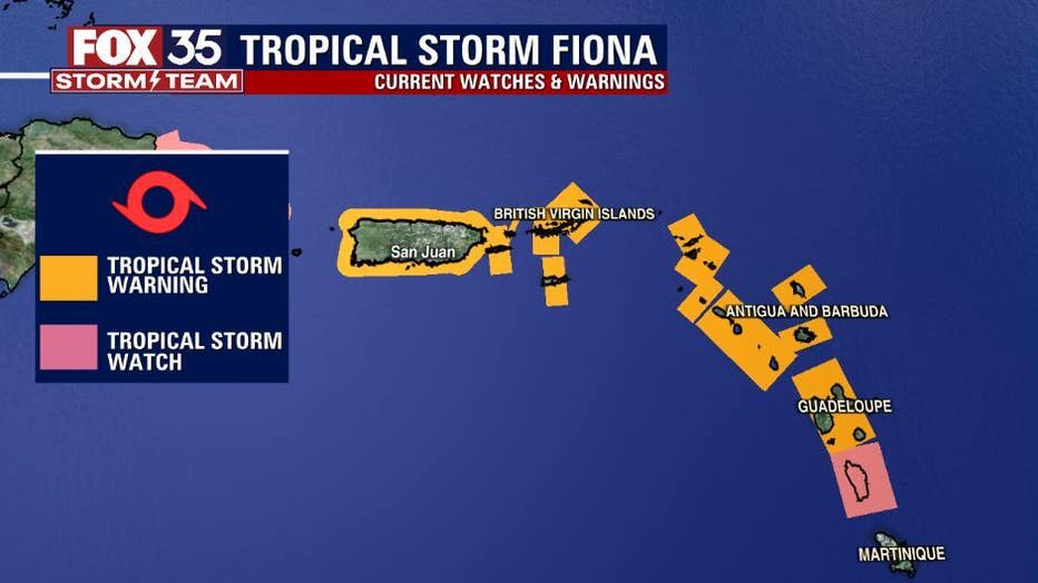
Tropical Storm FIONA is located over the distant Atlantic and will bring impacts to the Northern Caribbean Islands on it's current forecast track. Increasing winds and big tropical rains will overspread the islands this weekend.
Our EXCLUSIVE FOX MODEL is very much inline with the current FIONA forecast from the NHC. Long term tracking takes FIONA at moderate tropical storm intensity (winds at 60-65mph) across Puerto Rico this weekend and near the Dominican Republic by late weekend into early next week. From there our FOX MODEL takes the system closer to the Bahamas-Southeast of Florida.
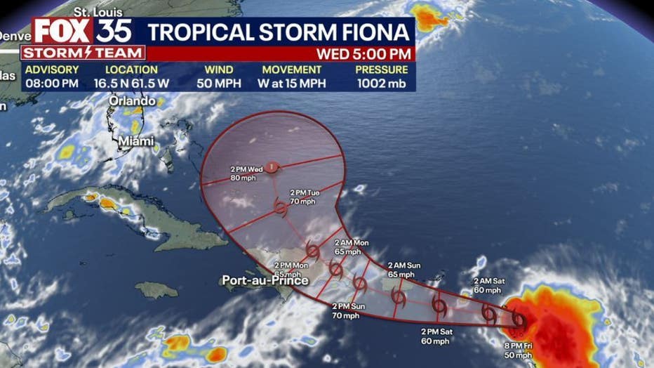
Most of the Hurricane models take the system through the Southern Bahamas and East of Florida.
You can depend on the FOX 35 STORM TEAM when it comes to tracking the tropics. Our FOX MODEL updates through the day and as those updates come in, we will share the latest with you!

