Orlando weather: Summer pattern of rainy afternoons to continue this week
Orlando Weather Forecast: July 18, 2023
Orlando and Central Florida will continue to see our summer pattern of rainy afternoons continue throughout the week.
ORLANDO, Fla. - Tonight's low: 76 degrees | Tomorrow's high: 93 degrees
Main weather concerns: It's going to be another sticky, steamy Central Florida day on Wednesday. Expect lots of humidity and high temps heading for the lower 90s inland, not much cooler along the beaches.
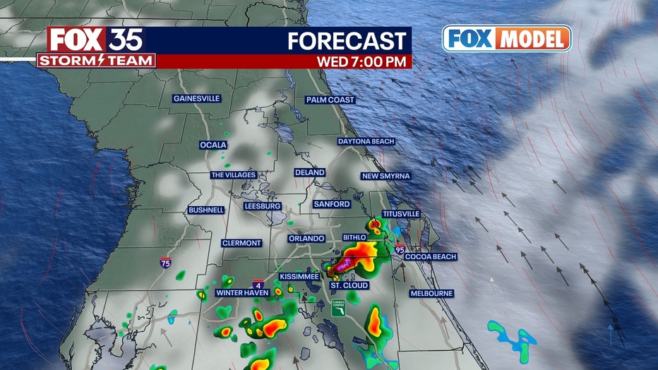
Rain chances return of course and mainly after 1-2 p.m. Coverage is not as widespread as in previous days as we head through the afternoon hours. Rain eases by late evening, falling to 20% coverage. Partly cloudy and muggy overnight with lows heading for the mid-70s.
BEACHES: The beaches start off looking good on this Wednesday, sunshine prevails early. Clouds will increase for the afternoon, rain chances rise in the early to mid-afternoon. Coverage ranges from 50-60%. Heavy downpours and lightning are the primary concerns. Surf remains on the smaller side as a distant ENE swell rolls into the beaches. Surf looks to increase a bit late week and into the weekend as a freshening mix of swell develops.
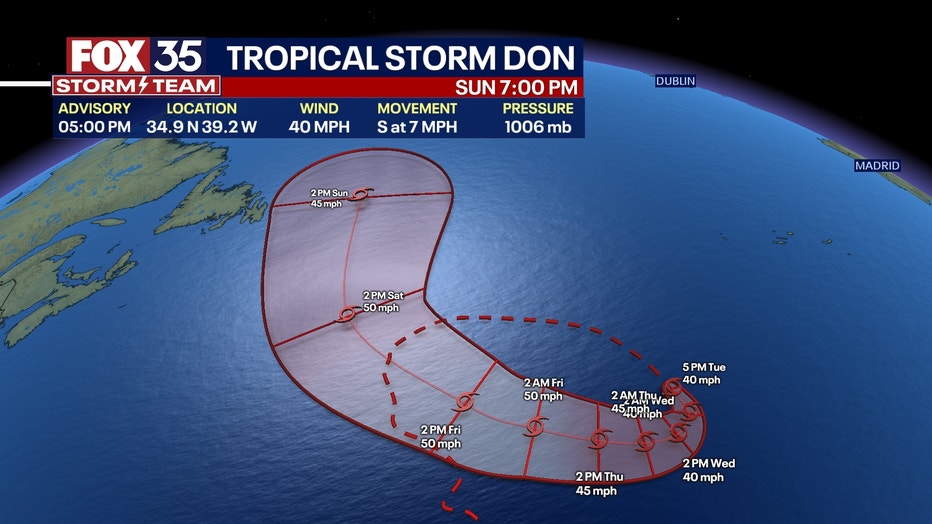
Some of the longer period swell entering the scene this weekend will be coming from distant Tropical Storm DON. While it won't be a huge pulse of swell, it's certainly possible that we're back in the rideable range longer term. High tide is around 8:30 a.m. and low tide is around 2:30 p.m.
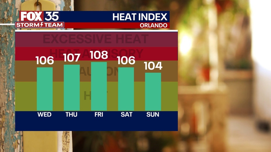
THEME PARKS: It will be humid at the theme parks. Highs will reach the low-90s with the heat index reaching the low 100s. Storm chances will rise by 2 p.m. with heavy rain, lightning, and the chance for gusty winds.

OUTLOOK: Rain chances drop midweek to around the 50% range. This will cause temperatures to bump up a bit into the mid-90s. Rain chances come down even lower by late week to around 40% coverage, this will keep the daily high temperatures on the higher side.

TRACKING THE TROPICS: Tropical Storm Don looks to gain some strength in the coming days, all while doing a wacky loop-type pattern over the open Atlantic. Don is no threat to land but, some of the swell energy generated by DON will trickle into beaches along the Eastern Seaboard over the next several days.

Longer term, the FOX 35 STORM TEAM is monitoring a wave exiting off of Western Africa over the next few days. Some forecast models are developing this feature as it moves Westbound through the Tropical Atlantic. We're watching this feature closely and will keep you updated in the coming days

