Wednesday will bring another round of afternoon storms as day heats up
ORLANDO, Fla. - Storms will linger into the early evening hours. They will continue to work eastward through the evening and gradually become more widespread along the Atlantic Coast.
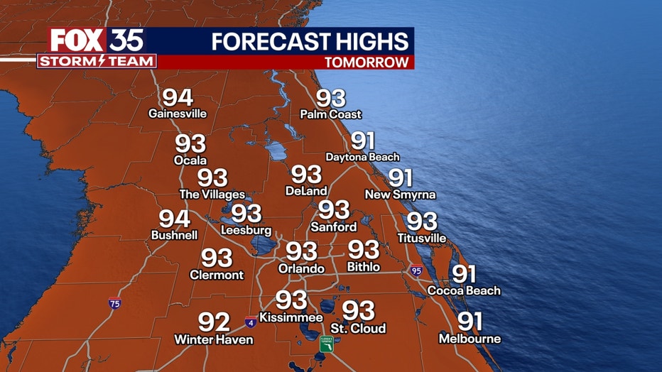
LOOKING AHEAD: The last few days of June will feel summer-like across Central Florida. Plan for daily rounds of afternoon showers, storms, and sweltering temperatures every day this week. Daily afternoon highs will be well into the low and mid-90s.
TROPICS: Forecasters at the National Hurricane Center in Miami are closely monitoring two areas that could develop further over the next week.

Extended models will bring Saharan dust to Florida and the Gulf of Mexico by this weekend, helping to limit much of our tropical development over the next week or so.