

Potential Tropical Cyclone 15 forms in Caribbean near Yucatán Peninsula; could become tropical depression
Potential Tropical Cyclone 15 forms in Caribbean
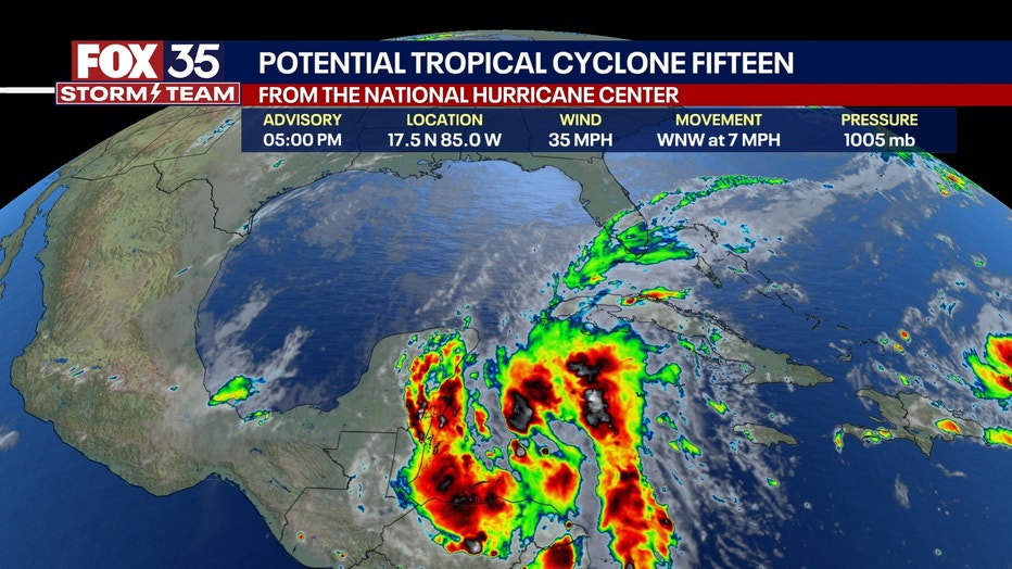
An area of low pressure and thunderstorms over the western Caribbean Sea, previously identified by the National Hurricane Center (NHC) as Invest 95L, has now been classified as Potential Tropical Cyclone 15 and could become a tropical depression or future Tropical Storm Nadine this weekend.
ORLANDO, Fla. - An area of low pressure and thunderstorms over the western Caribbean Sea, previously identified by the National Hurricane Center (NHC) as Invest 95L, has now been classified as Potential Tropical Cyclone 15 and could become a tropical depression or future Tropical Storm Nadine this weekend.
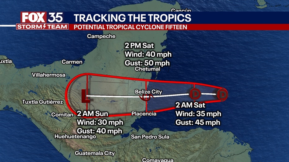
It is now positioned just northeast of eastern Honduras and is gradually getting better organized. Conditions are conducive for further development as we head into the weekend, with a high chance (70%) of the system forming into a tropical depression or storm before it moves inland over Belize and the Yucatán Peninsula on Saturday.
The government of Belize has issued a Tropical Storm Watch from Belize City northward to the border with Mexico, which has also issued a Tropical Storm Watch from the border with Belize northward to Tulum.
Maximum sustained winds were near 35 mph with higher gusts and some slow strengthening is forecast.
"This will likely be Tropical Storm Nadine hitting Belize on Saturday. Major flooding and mudslides are expected as this system develops," explained FOX 35 Storm Team Meteorologist Noah Bergren. "It will exit into the Pacific Ocean and possibly re-form into a large hurricane next week."
Widespread rainfall of 4-8 inches is expected across Northern Belize, northern Guatemala, and southern Mexican states from Quintana Roo westward to Veracruz. Isolated areas of amounts, exceeding 12 inches are also possible through late Tuesday.

Regardless of further development, locally heavy rainfall is expected across parts of Central America and southern Mexico through the weekend. Additionally, a stationary front north of the low is causing strong winds and rough seas in the Yucatán Channel. This front is expected to dissipate late Friday.
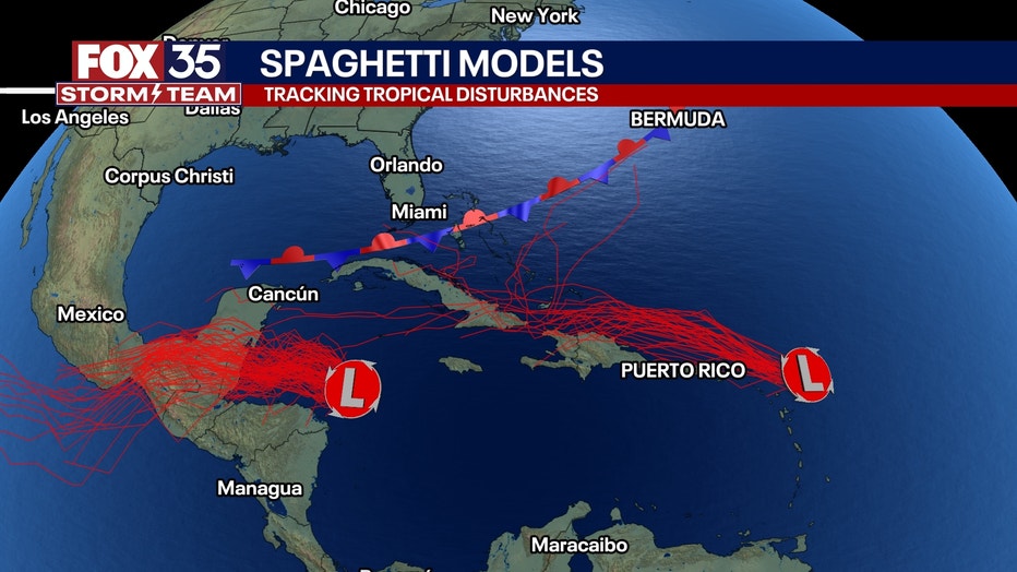
Invest 95L is one of two tropical systems that are being monitored by the NHC, the other being Invest 94L, east of the Leeward Islands.
Near the Leeward Islands (Invest 94L)
A poorly defined trough of low pressure near the northern Leeward Islands is producing disorganized showers and thunderstorms, with minimal potential for development.
The system, located north of the islands and over the adjacent Atlantic waters, is moving quickly west to west-northwest at around 20 mph.
It is expected to pass near or just north of the Virgin Islands and Puerto Rico on Friday, and then near Hispaniola and the southeastern Bahamas by Saturday.
Due to strong upper-level winds, significant development is unlikely over the weekend.
The National Hurricane Center (NHC) estimates the chance of formation within 48 hours at 20%, and within seven days also at 20%.
Neither of these systems is expected to impact Florida.
Orlando 7-Day Weather Forecast

Orlando Hour-by-Hour Weather Forecast

FOX 35 Storm Tracker Radar
Track live when storms move across your area using the FOX 35 Storm Storm Tracker Radar below.

More radar maps from FOX 35 Storm Tracker Radar
- Brevard County
- Flagler County
- Lake County
- Marion County
- Osceola County
- Orange County
- Polk County
- Seminole County
- Sumter County
- Volusia County
- U.S./National Radar
STAY CONNECTED WITH FOX 35 ORLANDO:
- Download the FOX 35 News app for breaking news alerts, the latest news headlines
- Download the FOX 35 Storm Team Weather app for weather alerts & radar
- Sign up for FOX 35's daily newsletter for the latest morning headlines
- FOX Local: Stream FOX 35 newscasts, FOX 35 News+, Central Florida Eats on your smart TV